Feb 2020 Update
Upto date info on Facebook : https://www.facebook.com/groups/IDigHealeyNab/
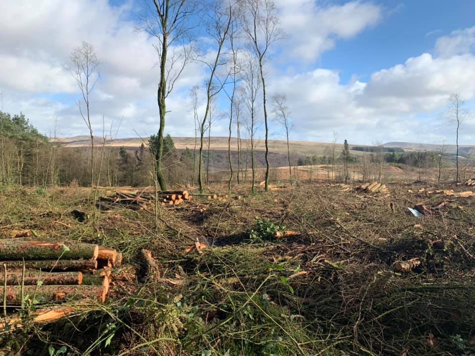
Healey Nab is currently undergoing felling to remove diseased larch, and this is having a major impact on the trails, and the rideability is changing on a daily basis, so please check the Facebook group for reports.
Once the felling is finished the dig team will have a big push to reinstate the trails, but as yet we are unsure what the time needed, or damage to repair will be. It would be a great time for extra people to join the small team of volunteers and speedily get to work on the rectifications with Scott, the dig leader, who will liaise with Lancs CC on permissions etc. Again, check out the Facebook group!
Scott on 23rd Feb gave the update "Hi all, been up today to see whats what, as it is, the full red is not rideable. There are blockages along the route from the big climb onwards. Judging by process and location of the machine, it's only a day or so till they're on with the main bulk, so if mostly say its probably not worth it after the next few days. Once everything is finished, I'll be assessing what needs doing and posting a dig, we're going to need all hands on deck to get them back running well, every little helps so even half an hour of your time is more than greatly appreciated."
Healey-Nab-Feb-2020
Healey Nab is a wooded mound of elevation about 300 ft. formerly quarried, between The White Coppice and Chorley, Lancashire, The Nab is LCC owned and sits apparently isolated on the western edge of the West Pennine Moors.
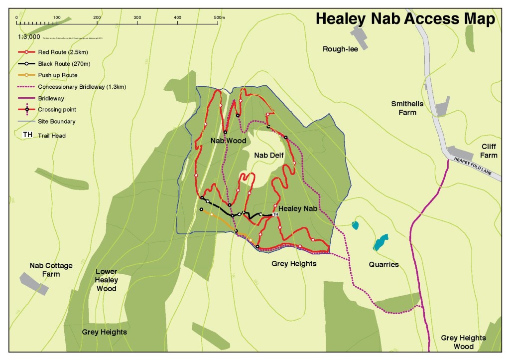
Trail Map: - Click for larger
How it happened.
Healey Nab was attracting some unofficial trail building, effectively a good sign that the demand for local bikers existed, and the terrain is suitably challenging. The objections of this early activity were about the unsustainable construction methods combined with dangerous and conflicting activity with the interests of other users. Basically soft timber logs were being used to construct berms and ramps for jumps which sometimes actually crossed other rights of way.
When, during 2008 Ian Hart was ready to develop Healey Nab, Bill Ould accompanied Ian on a tour of Lee Quarry guided by Tony Lund. They saw first-hand what had been achieved there, but were of one mind that a less adventurous trail was right for Healey Nab. Rowan Sorrell, already emerging as an influential architect was selected to carry out a site survey at Healey Nab and make a plan as designer for the mountain-bike specific trails on the site. Tenders for work followed and the contractor Terra Firma was appointed, with Rowan retained as designer and architect.
How the Trails were built
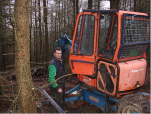
After a thinning of the plantation work to construct the XC trail started on the hill site in late 2008. The walking excavator was used to remove the surface leaf litter and brown soil, then to move exposed rock, and to create the new riding surface using borrow pit material before advancing.
There was progress and lots to discuss, as crossings and points of interest arose, but because of poor weather etc the track did not grow quickly. Notwithstanding, first one section, then another was completed, taking the trail to the lowest access track, and providing the first opportunity to ride down the hillside in one continuous run. Despite early murmurings from the riding public there was subdued approval. The main problem just not enough – want more!
 In conjunction, a volunteer workforce was mobilised, still under the watchful eye of Rowan Sorrell, but given freedom to build a more downhill orientated trail that might involve and excite the more extreme riders, through the plantation on the western side, where is the steepest gradient. It was hoped the local riders involved would take some responsibility for the continued responsible use of the Nab and trails. This volunteer work was coordinated through the web-based forum of Blackburn and District Mountainbikers (BAD), where vocal space was provided for any anonymous supporter or objector. It did work. The rather fragmented groups of riders were drawn together and within a three month period in the Spring of 2009 on Saturdays the Black Run was carved and shaped using tools provided with instruction and risk assessed by Ian Hart. It has to be said the volunteer workforce were made up not of your average club member or cross-country rider but more from the extreme and competitive downhill rider groups who are more desperate than any of the other user groups to see something useful
 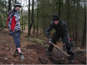 developed, and the final result reflected this workforce. At this time uncontrolled riding through the ornamental gardens of Rivington Hall was being stopped, and any hint of a legal ride was welcomed. The final shape and challenge to riders was tempered by the need for permanence and mindful to the health and safety of any other visiting user groups. So, whilst big jumps are a feature, these are well away from any conflict with other users, and also with the possiblility to “roll through” the feature without the risk of a bone breaking event. Many separate lines are also a feature so the trail will continue to entertain. The resultant Black trail has already served a complete year and with only minor repairs necessary, again, completed on volunteer working days.
Rowan and TF returned to site after an absence and the trail route was marked out and the digger started. This section, without any help from gravity is probably the most challenging. As it lies on the lower slopes available it is the wettest by far and springs are even marked on the OS map, so drainage was always to be a challenge. Clever design where the trail undergoes what is known as regular grade reversals should ensure there is minimal accumulation of water actually on the trail. In 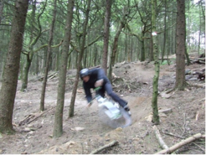 practice TF did not execute this at all cleverly so following prolonged wet there were pools of accumulation, and the higher proportion of clay almost liquidised into a sticky and slippery surface. Work continued to approach the NE gate to the plantation near Higher Healey Farm. This completed the work agreed for the first contract and perhaps a bit more than a km of trail, however if riders followed the trail they might feel somewhat stranded without a defined return route.
On an earlier survey visit with Ian hart, we were almost in collision with a descending rider on the concessionary bridleway as we climbed to the quarry . This rather emphasised the need to separate climbing riders and descending riders, indeed the preference to organise riders into circular flow and away from potential conflict with horses. A winding technical climb was conceived with a gentle return to the summit and trail-head. Following a further delay through attracting a fundimg stream and also non-availability of the contractor, work was re-started in the late autumn, and by December 2009 the trail had arrived at the trail-head. This added a further length to the available trail which altogether total around 2kms, and comprise a meaningful circuit.
By May 2010 a red graded XC circuit was nearing completion, Terra Firma’s work has provided a further length of trail back to the SE gate, and some trail-head clearance. TF’s work has been regularly monitored under the watchful eye of Rowan Sorrell as trail designer, who can provide some accreditation when trailhead layout and direction and trail feature signing too is all in place. Trail Direction arrows and approaching hazards will be signed, and complement the trail-head info board.
The development has not been all harmonious. Unauthorised construction of trails has proliferated and it has been difficult to bring the fragmented riding groups together. There has been further disharmony with the contractor Terra Firma, their availability and quality of trail. Rowan Sorrell had good vision for the trail development but was beaten on the price of his tender for construction. The point of learning has been that any contracted trail construction will probably progress better if the architect/designer and construction team are one of the same organisation, and continuously on-site together.
 How to get to Healey Nab
The trails at Healey Nab are best accessed on two wheels from Heapey Fold Lane, and are very suitable for stopping by for an hour as part of a longer ride perhaps taking in some lunch whilst you are there. The nearest organised parking can be found at Rivington, and White Coppice for those more minded to session the place or to make it a social gathering.
There is concessionary bridleway access to the Nab which is wooded at its crown, and is visible from the M61 just to the south of Botany Bay and for miles around. The trail-head can be found along a short access trail leading into the wood from one of only two viewpoints – the one with a cairn amongst gorse, and from where views towards Winter Hill, and the Pike, also the kingdoms of Liverpool and the Fylde may be observed.
The Healey Nab MTB Trails - what you’ll find when you get there
At the trail-head there is an open clearing with many trails appearing to radiate outwards. A Notice board will provide some guidance, along with the trail markers. Because of the exploitation of the compact space many crossing points are necessary both of the Red and Black trail but also of other rights of way. Care in design and layout enables rider, walker, rambler, and horse rider to have an early sighting of one another and should not be startled. For the uninitiated best ride the Red first then you will see just how much more skill is required to ride a Black graded trail. All riders like the Red anyway and you’ll get a tour of the Nab.
The Red trail and Black trail have a common start, although maybe the efforts of our Black trail-builders will eventually get the separate elevated starting platform they wish.


The Black Trail:
Constructed using the volunteer force as described, separates to the right from Red through a symbolic rock gateway and crosses down a rock garden qualifier. The track follows a more direct route through the wood making good use of gravity and elevation for a muted exploitation of speed, turns and jumps. The Black trail features a wall drop, berms, and rock gardens, with log ride and skinny as alternative routings through the steepest section, with a big jump, a tabletop and a big berm to end the descent. A push-up route to the side of the trail will permit the rider to view and possibly to photograph his mates’ technique as they add another grin to their experience. Each descent a couple of minutes of grin!
 The Red grade trail
Through the first two sections is a swooping descent with rock steps, berms and crossings, requiring the occasional pedal turn to exploit the boundaries of the plantation to the quarry embankment. This emerges beside the exit from the Black Trail. Whilst the downhillers push back up, the Red Route continues into its third section, a low undulating traverse with a wall crossing and some challenging twists associated with the biggest berms amongst the evergreen Western Hemlock, before gravity takes you to the lowest point of the trail.
A twisting and gradual climb through the plantation starts here. A short length of Concessionary trail by the NE gate leads to section 4, an interesting climb, completed with a short section which has been “natural” with exposed roots to develop your root-riding skills and re-joins the concessionary trail near the quarry.
Section 5 is a gentle and winding exploration of the plantation and leads the rider back to the trail-head! Why not make a second tour or try the Black Trail before heading home. The 6thand final section of trail is the way to leave with a bit of flare. From the trail-head is a bermed and flamboyant descent to the S.E. gate to send you on your way down the concessionary track back towards Heapey Fold Lane. The Red Grade trail is approaching 2 kms in length. Just for fun!
To the future!
Ongoing, the volunteers have formed their own Facebook Group and website “I Dig Healey Nab” and appear well set to continue taking responsibility for the ongoing maintenance of the trails. Healey Nab will be featured on the West Pennine Moors website. The downhill riders are collectively still searching for their own piece of trail – no compromises for XC wimps a full-on downhill course of competition quality where they can practice. Meanwhile they continue to make enthusiastic use Healey Nab and make sorties to unauthorised sites.
To finish off a little video of Healey Nab.
|
Healey Nab Promo Video from TartyBikes on Vimeo. |
Downloads
Weather
This Weather Widget is provided by the Met Office
Links
West Pennine Moors - Healey Nab
Blackburn and District Mountain Bikers